Menu Home

Places

Select any filter and click on Apply to see results

All Places

Shilshole

Shilshole Bay Marina

Marina

Latitude and Longitude

47° 40' 39" N , 122° 24' 39" W

General Information

Staff on-site 24 hours
Office Hours: Monday - Saturday, 8:00am - 4:30pm

How To Start Your Cruise Off Right

Smith Cove Cruise Terminal at Pier 91

Cruise Terminal

General Information

Pier 91 serves as home port for Carnival Cruise Line, Celebrity Cruises, Holland America Line, Princess Cruises and Royal Caribbean. Located at the north end of Seattle's waterfront on historic Smith Cove, it's just 10 minutes from the city's retail core and the famous Space Needle and a 30-40 minute direct ride to the airpo

8th Avenue South Park, Seattle, Oct. 2018

t̓ałt̓ałucid Park and Shoreline Habitat

Waterfront Park

Latitude and Longitude

47320° 0' 0" N , 122192° 0' 0" E

General Information

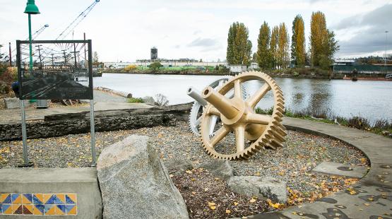
The 17,500 square-foot t̓ałt̓ałucid Park and Shoreline Habitat, formerly 8th Ave. South Park, was once the site of a swing bridge that connected South Park and Georgetown. Now a favorite lunch spot for local workers and residents, visitors to the park can watch industrial vessels like barges and tugboats float by as well as observe waterfowl and other wildlife. Tribal fishers exercise their Treaty rights nearby and harvest adult returning salmon in this area.

Terminal 18 Park

Terminal 18 Park

Waterfront Park

Latitude and Longitude

47° 34' 20" N , 122° 21' 14" W

General Information

If you’ve ever been curious about all the port activity that takes place on Harbor Island between West Seattle and downtown, visiting Terminal 18…

Elliott Bay Trail

Terminal 91 Bike Trail (Elliott Bay Trail)

Waterfront Park

General Information

Southeast access: 47.631609, -122.377859;
Southwest access: 47.633540, -122.387100

view of the Tokyo boardroom showing the wooden table, with 10 chairs set around the table.

Tokyo Conference Room

Conference Facility

General Information

Included features: 72" Flat screen TV with HDMI adapter In-room Laptop with docking station Wireless keyboard and mouse Polycom conference phone…

A man and his dog look toward the Duwamish River where a barge with containers glides by. August, 2018, Seattle.

t̓uʔəlaltxʷ Village Park and Shoreline Habitat

Waterfront Park

Latitude and Longitude

47343° 48' 0" N , 122213° 0' 0" E

General Information

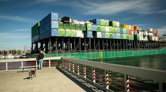
t̓uʔəlaltxʷ Village Park and Shoreline Habitat, formerly known as Terminal 105 Park, offers a 50 foot fishing pier and a sweeping view of the Duwamish River estuary. A creek runs along the south side of the 1.2 acre park, emptying into the Duwamish. In addition to three picnic tables and a covered gazebo, the park has 220 feet of shoreline access where guests can watch machinery and boats in action. Hours are from dawn to dusk.

Back to Top