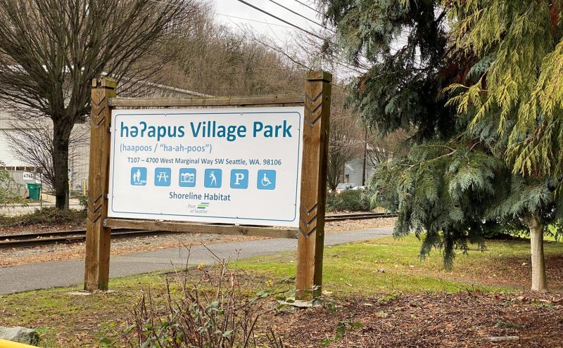
həʔapus Village Park and Shoreline Habitat
- Map & Directions
- həʔapus Village Park & Shoreline Habitat on Google Maps 4500 Duwamish Trail HJ5X+GG Seattle, Washington
- Latitude, Longitude
- 473341° 0' 0" N, 1222100° 0' 0" E
- General Information
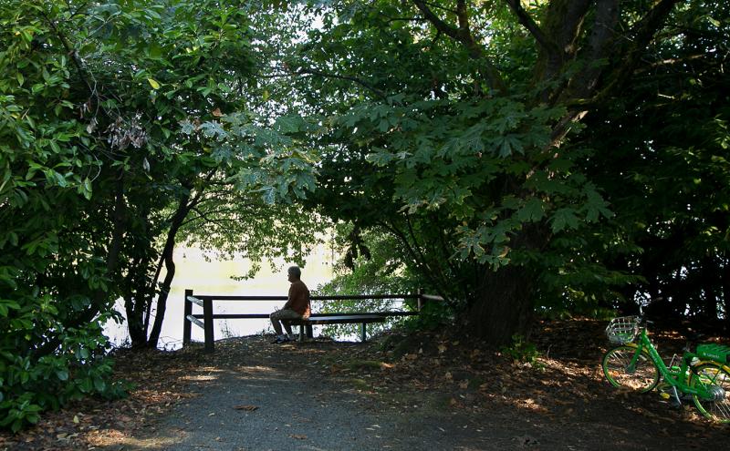
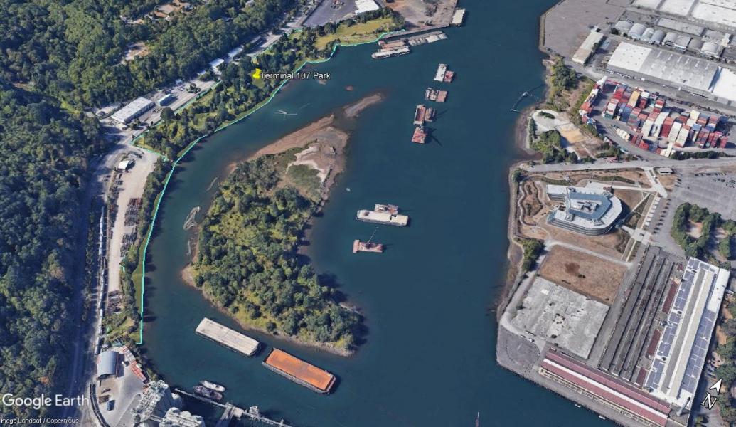
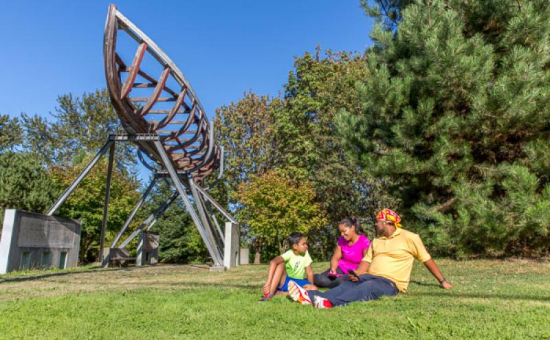
- həʔapus Village Park and Shoreline Habitat (formerly Terminal 107 Park) is an important archaeological, cultural, and ecological site that sits on the shores of one of the last remaining original bends of the Duwamish River. Located just off West Marginal Way across from the Duwamish Longhouse and Cultural Center, the park offers more than seven acres of native landscape park area along a vibrant river shoreline. Park hours are dawn to dusk.
həʔapus Village Park and Shoreline Habitat
həʔapus (ha-ah-poos) is the name of a small stream draining across a flat on the west side of Duwamish River. Spoken by Warren King Geoge, historian for the Muckleshoot Indian Tribe. Listen to how it sounds! həʔapus Village Park and Shoreline Habitat
Formerly: Terminal 107 Park
Previously known as Terminal 107 Park, həʔapus Village Park and Shoreline Habitat is an important archaeological, cultural, and ecological site that sits on the shores of the Duwamish River. Located just off West Marginal Way across from the Duwamish Longhouse and Cultural Center, the park offers over seven acres of native landscape along a vibrant shoreline that volunteers continue restoring to this day.
Coast Salish uses and history
həʔapus Village Park and Shoreline Habitat was the ancestral site of the Indigenous village of yile’qwud (Yee-LE-kwud), referring to a Yakama-style basket hat. The village consisted of large cedar plank longhouses where multiple families shared living and community space. A small creek, draining across a flat, on the west side of the river also served as a marker for this site, which was known as həʔapus.
Standing at the shoreline looking east, you can see Kellogg Island, which is a small remnant of a large historic island. Its original name was Mud Island and exceeded 315 acres. Looking south from the park’s shoreline, you can also see the last remaining original bend of the Duwamish River. This view offers you a rare chance to imagine what the area looked like 1,000 years ago.
Settler uses and history
Multiple important Indigenous village and water-related places congregated around this site. However, in 1865, the City of Seattle banned Native Americans from living within Seattle city limits. In 1893, non-Native colonists burnt down a nearby Coast Salish settlement known as t̓uʔəlaltxʷ (t-oo-ah-lal-too-wx), “Herring’s House”, which forced many Indigenous people to relocate. Today, həʔapus Village Park and Shoreline Habitat is adjacent a City-owned park named after that village, even though it was originally located further north.
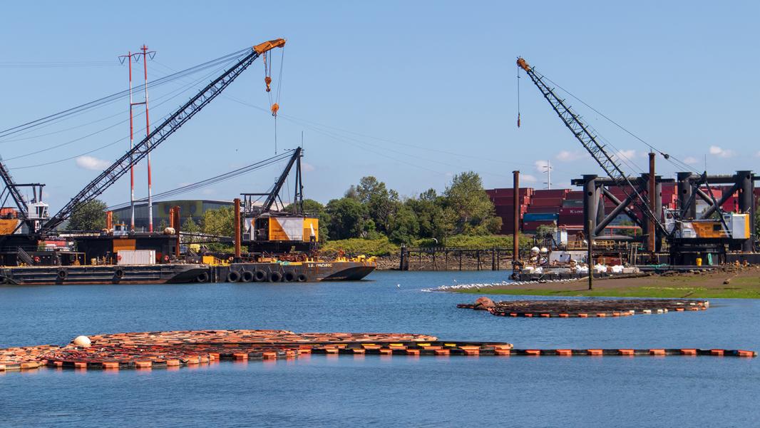
In the first decades of the 1900s the river and estuary was straightened and deepened to facilitate industrial uses. This new dredged straightened path is what is seen today beyond Kellogg Island and the secondary curving channel is adjacent to the site.
Industrial uses and history
From the early 1930s to 1970s industry bloomed around this site due to Boeing and Seattle’s industrial growth. As a result, pollution skyrocketed. During this time, after the displacement of Indigenous residences, the site was inhabited by new settlers including Croatian and Norwegian immigrants who began using it as a residential and commercial area. Past industrial uses and activities included lumber mills, brick factories, vessel navigation, and wooden boat construction.
The port purchased the site in early 1972 to build a large marine cargo facility. In 1977, as buildings were being demolished, historic artifacts were found by the Duwamish Tribe and US Army Corps of Engineers representatives, which halted construction and led to the preservation of the area. In 1977, the site was added to the National Register of Historic Places under the name “Duwamish #1 Site,” which dated Coast Salish settlements at this site as early as 1999 BC.
Conservation uses and history
Today, həʔapus Village Park and Shoreline Habitat stands as a public access site and serves as a critical habitat area for salmon and other migratory fish and wildlife to rest, feed and escape from predators. Upon designation, the area was left inactive until 2000, when it was constructed as a shoreline access site and park, as part of mitigation related to a cargo terminal re-development.
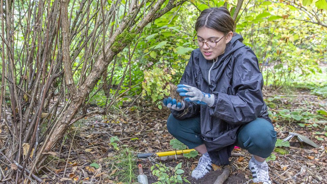
Since 2006, the Duwamish Alive Coalition has organized biannual hands-on habitat restoration activities to support environmental education and community action to restore river habitat for Chinook salmon and other migratory wildlife along the Duwamish River. Each spring and fall, the coalition hosts a work party where over 50 volunteers of diverse ages and ethnicities join in for a day of pulling invasive weeds, planting trees, and learning about the site’s history.
Community uses and history
Year-round, youth from the Duwamish Valley Youth Corps participate in Duwamish Alive by restoring and cleaning the park. Many local Duwamish Valley youth lack the same access to parks and open spaces that youth in other parts of the city have. Thanks to the combined efforts of many organizations, youth now come by on their free time to explore həʔapus Village Park and Shoreline Habitat.
More families that live in South Park and Georgetown are learning about this park and sharing its history with their loved ones. The Duwamish Longhouse and Cultural Center, located across the street, provides public tours and youth education projects related to the site due to its significant historical and cultural value to Seattle’s First People.
Lushootseed is a Coast Salish Indigenous language spoken by many tribal communities in the Puget Sound region. The Duwamish River area has ancestrally been, and still is, a very active cultural area for Indigenous peoples from many backgrounds. This area is also one of the most ethnically and linguistically diverse in the city. Many immigrant and refugee communities are residents or have cultural connection to the area, especially Latinx, East Africans, Southeast Asians, and Pacific Islanders.
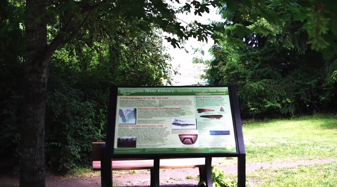
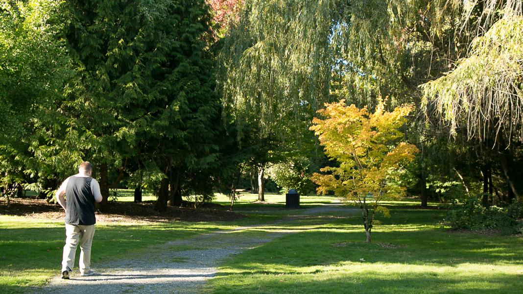
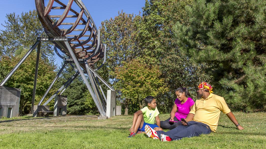
Public shoreline access features
- Intertidal ancestral bend of river with wildlife viewing
- Adjacent to Duwamish Trail along West Marginal Way
- Salmon Safe Certified Park
- Walking paths and trails
- Four shoreline seating and three river viewpoints
- Picnic tables and information kiosk
- Two hand-carried boat launch paths
- A water fountain/hand-wash station
- Paved, off-street parking for up to 20 vehicles
- Open turf areas
- Public art and interpretive signage
Sources
Blomberg, G. (2020). Sr. Environmental Program Manager, Port of Seattle. (G. Lee, Interviewer) Seattle.
Buerge, D. M. (2020). Historian and Author, "Chief Seattle and the Town That Took His Name: The Change of Worlds for the Native People and Settlers on Puget Sound". (G. Lee, Interviewer) Seattle.
Burke Museum of Natural History and Culture, et al. (2014). The Waterlines Map. Retrieved from https://www.burkemuseum.org/static/waterlines/project_map.html
Cummings, B. (2020). Author, "The River That Made Seattle: A Human and Natural History of the Duwamish". (D. Edamura, Interviewer)
Hilbert, V., et al. (2001). Puget Sound Geography: Original Manuscript from T.T. Waterman. Federal Way: Lutshootseed Press.
Leischman, S. (2020). Manager, Duwamish Alive Coaliton. (D. Edamura, Interviewer)
Medina, R. M. (2020). Friends of Georgetown History, Board President. (G. Lee, Interviewer)
Muckleshoot Indian Tribe. (2020). History of the Muckleshoot Indian Tribe and its Reservation. Retrieved from http://www.muckleshoot.nsn.us/about-us/overview.aspx
National Register of Historic Places. (1977, October 18). Digital Archive on NP Gallery. Retrieved from https://npgallery.nps.gov/NRHP/AssetDetail?assetID=534c7e57-7c7f-43a2-9…
Ott, J. (2014, November 10). Sdzidzilalitch (Little Crossing-Over Place). Retrieved from HistoryLink: https://www.historylink.org/File/10965
Ott, J. (2014, December 7). Seattle Board of Trustees passes ordinance, calling for removal of Indians from the town, on February 7, 1865. Retrieved from HistoryLink: https://www.historylink.org/File/10979
Rasmussen, J. (2020). Superfund Cleanup Manager, Duwamish River Cleanup Coalition. (D. Edamura, Interviewer)
The Duwamish Longhouse and Cultural Center. (2020). Duwamish: Our History. Retrieved from https://www.duwamishtribe.org/history
The Seattle Civil Rights & Labor History Project at University of Washington. (2020). Retrieved from https://depts.washington.edu/civilr/segregated.htm
The Suquamish Tribe. (2020). History and Culture. Retrieved from https://suquamish.nsn.us/home/about-us/history-culture/#tab-id-5
Waterman, T. (1922). The Geographical Names Used by the Indians of the Pacific Coast. The Geographical Review, pp. 12:175-194.
Related to həʔapus Village Park and Shoreline Habitat
Waterfront Parks
Welcome to our Parks. The Port of Seattle has more than 44 acres of parks and public access sites that include scenic bike and pedestrian trails, picnic areas, habitat restoration areas, fishing piers...
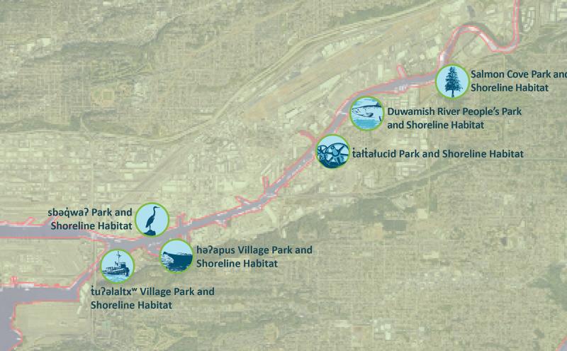
Port Announces New Names for Six Parks along the Duwamish River
The Port of Seattle Commission voted to adopt new, community-sourced names for six Port-owned parks and shoreline habitat areas along the Duwamish River. The names reflect the cultural, historical and...